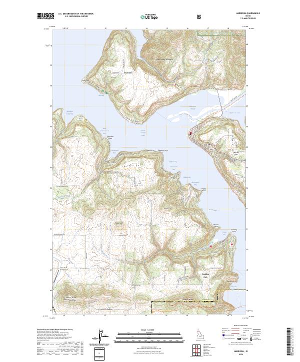
2024 Map of Harrison
USGS Topo · Published 2024About this map
Harrison occupies a prominent point where the Coeur d'Alene River meets the expansive waters of Coeur d'Alene Lake. This modern topography shows the lakeside settlement's layout, including the Harrison Cem and the nearby Harrison Flats. The map details a complex shoreline of inlets and bays such as Bell Bay, Cottonwood Bay, and Bloomsburg Bay, illustrating how the water dictates the local geography.
Find a feature on this map
108 named features on this map. Tap any name to fly to it.
Don’t see what you’re looking for? This feature index may not catch every label — zoom into the map to look around manually.
Map Details
Editions of this 2024 Harrison Map
This is the sole edition of this map. No revisions or reprints were ever made.
Other maps of this area

1903 · Rathdrum
USGS Topo · 1:125,000

1955 · Spokane
USGS Topo · 1:250,000

1957 · St. Maries
USGS Topo · 1:62,500

1957 · Plummer
USGS Topo · 1:62,500

1957 · Coeur D'Alene
USGS Topo · 1:62,500

1957 · Lane
USGS Topo · 1:62,500

1958 · Spokane
USGS Topo · 1:250,000

1975 · Plummer NW
USGS Topo · 1:24,000

1975 · Plummer SE
USGS Topo · 1:24,000

1975 · Coeur D'Alene SE
USGS Topo · 1:24,000