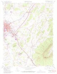
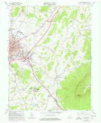
1964 Map of Harrisonburg
USGS Topo · Published 1987About this map
Harrisonburg and its surrounding Rockingham County landscape are defined by the convergence of the Southern and Chesapeake Western railroads against the dramatic rising slopes of Massanutten Mountain. This era captures the city during a period of mid-century expansion, evidenced by the presence of Madison College and institutional growth near the downtown core, including the Muni Bldg and Hospital. The survey meticulously records local infrastructure, from the Drive-in Theater near Melrose to the Massanutten Caverns east of Keezletown. Significant genealogical data is preserved through numerous burial grounds like Woodbine Cem and the Hebrew Cem, alongside suburban developments such as Spotswood Country Club. To the south, Lake Shenandoah and the Lakeview Golf Course indicate the shift toward recreational land use as the city's influence reached toward Penn Laird and Peales Crossroads.
Find a feature on this map
58 named features on this map. Tap any name to fly to it.
Don’t see what you’re looking for? This feature index may not catch every label — zoom into the map to look around manually.
Map Details
Editions of this 1964 Harrisonburg Map
5 editions found
Other maps of this area

1892 · Woodstock
USGS Topo · 1:125,000

1892 · Harrisonburg
USGS Topo · 1:125,000

1937 · Elkton
USGS Topo · 1:62,500

1941 · Harrisonburg
USGS Topo · 1:62,500

1942 · Mt Jackson
USGS Topo · 1:62,500

1943 · Harrisonburg
USGS Topo · 1:62,500

1946 · Mt Jackson
USGS Topo · 1:62,500

1947 · Mt Jackson
USGS Topo · 1:62,500

1947 · Broadway
USGS Topo · 1:62,500

1949 · Charlottesville
USGS Topo · 1:250,000