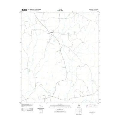
2012 Map of Harrisville
USGS Topo · Published 2012About this map
Harrisville and the nearby community of Union anchor this 2012 survey of Simpson County, Mississippi. The landscape is defined by the headwaters of numerous creeks, including Limestone Cr, Little Limestone Cr, and Little Cr, all draining toward the southern boundary marked by the Strong River. This network of tributaries creates a series of low ridges where residential roads and farm properties are concentrated, particularly along routes like Harrisville Braxton Rd and Harrisville Rd. Local history and genealogy are well-represented by several family and community burial grounds, such as Harrisville Cem, Bethlehem Cem, and Mount Olive Cem. The drainage patterns, particularly around Durden Br and Big Cr, illustrate the rural settlement structure of the early 21st century, where development follows the subtle elevations between the many small watercourses that feed into the larger river system to the south.
Find a feature on this map
86 named features on this map. Tap any name to fly to it.
Don’t see what you’re looking for? This feature index may not catch every label — zoom into the map to look around manually.
Map Details
Editions of this 2012 Harrisville Map
This is the sole edition of this map. No revisions or reprints were ever made.
Other maps of this area

1903 · Jackson
USGS Topo · 1:125,000

1906 · Florence
USGS Topo · 1:62,500

1908 · Florence
USGS Topo · 1:62,500

1953 · Hattiesburg
USGS Topo · 1:250,000

1953 · Meridian
USGS Topo · 1:250,000

1953 · Natchez
USGS Topo · 1:250,000

1955 · Jackson
USGS Topo · 1:250,000

1956 · Natchez
USGS Topo · 1:250,000

1957 · Meridian
USGS Topo · 1:250,000

1958 · Hattiesburg
USGS Topo · 1:250,000