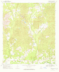
1970 Map of Harrisville
USGS Topo · Published 1972About this map
The settlement of Harrisville serves as the central hub of this Simpson County landscape, documented during a period of transition in the late 1960s. The geography is defined by a dense network of waterways, including Limestone Creek and the Strong River, which shape the rural settlement patterns. Transport history is etched into the terrain by the Old Railroad Grade, which once connected these timber and agricultural communities to broader markets.
Find a feature on this map
23 named features on this map. Tap any name to fly to it.
Don’t see what you’re looking for? This feature index may not catch every label — zoom into the map to look around manually.
Map Details
Editions of this 1970 Harrisville Map
This is the sole edition of this map. No revisions or reprints were ever made.
Other maps of this area

1903 · Jackson
USGS Topo · 1:125,000

1906 · Florence
USGS Topo · 1:62,500

1908 · Florence
USGS Topo · 1:62,500

1953 · Hattiesburg
USGS Topo · 1:250,000

1953 · Meridian
USGS Topo · 1:250,000

1953 · Natchez
USGS Topo · 1:250,000

1955 · Jackson
USGS Topo · 1:250,000

1956 · Natchez
USGS Topo · 1:250,000

1957 · Meridian
USGS Topo · 1:250,000

1958 · Hattiesburg
USGS Topo · 1:250,000