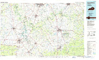
1986 Map of Harrodsburg
USGS Topo · Published 1986About this map
Harrodsburg and the surrounding Bluegrass region are documented here in the mid-1980s, showcasing a landscape where deep historical roots meet modern infrastructure. The Kentucky River carves a winding path through the center of the sheet, flanked by the Fort Boonesborough State Park and the rugged transition toward the Pottsville Escarpment in the southeast. This era represents the height of regional connectivity, with the Blue Grass Parkway and I-75 intersecting older thoroughfares that once followed pioneer traces.
Find a feature on this map
271 named features on this map. Tap any name to fly to it.
Don’t see what you’re looking for? This feature index may not catch every label — zoom into the map to look around manually.
Map Details
Editions of this 1986 Harrodsburg Map
This is the sole edition of this map. No revisions or reprints were ever made.
Other maps of this area

1891 · Manchester
USGS Topo · 1:125,000

1892 · Richmond
USGS Topo · 1:125,000

1892 · Beattyville
USGS Topo · 1:125,000

1893 · London
USGS Topo · 1:125,000

1897 · Richmond
USGS Topo · 1:125,000

1897 · London
USGS Topo · 1:125,000

1905 · Harrodsburg
USGS Topo · 1:125,000

1906 · Georgetown
USGS Topo · 1:62,500

1908 · Georgetown
USGS Topo · 1:62,500

1922 · Frankfort
USGS Topo · 1:48,000