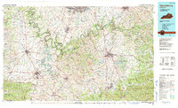
1991 Map of Harrodsburg
USGS Topo · Published 1991About this map
Kentucky River loops and the winding Dix River define the central Kentucky landscape, where the Bluegrass region meets the rising terrain of the Knobs. The deep gorge of the river system is prominent at High Bridge and Shakertown, highlighting the historical significance of these river crossings and religious settlements. To the east, the map captures the transition into the Daniel Boone National Forest, anchored by the foothills of Muldraughs Hill and notable peaks like Pilot Knob and Indian Fort Mountain.
Find a feature on this map
339 named features on this map. Tap any name to fly to it.
Don’t see what you’re looking for? This feature index may not catch every label — zoom into the map to look around manually.
Map Details
Editions of this 1991 Harrodsburg Map
This is the sole edition of this map. No revisions or reprints were ever made.
Other maps of this area

1891 · Manchester
USGS Topo · 1:125,000

1892 · Richmond
USGS Topo · 1:125,000

1892 · Beattyville
USGS Topo · 1:125,000

1893 · London
USGS Topo · 1:125,000

1897 · Richmond
USGS Topo · 1:125,000

1897 · London
USGS Topo · 1:125,000

1905 · Harrodsburg
USGS Topo · 1:125,000

1906 · Georgetown
USGS Topo · 1:62,500

1908 · Georgetown
USGS Topo · 1:62,500

1922 · Frankfort
USGS Topo · 1:48,000