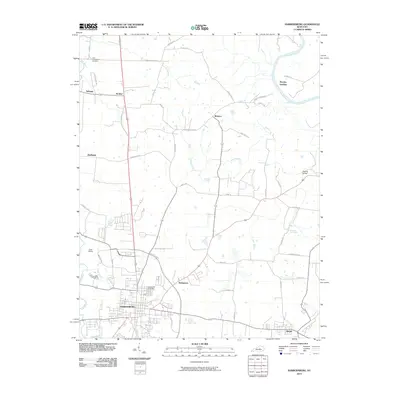
2010 Map of Harrodsburg
USGS Topo · Published 2010About this map
Harrodsburg serves as the focal point of this Central Kentucky landscape, where the town's grid meets a sprawling network of rural pikes and country lanes. The geography is defined by the winding course of the Kentucky River at Mundys Landing and the steady flow of the Salt River to the west. Local history is etched into the terrain through family-named landmarks and historical crossroads like McAfee, Braxton, and Stringtown. The map captures a transition in infrastructure, showing the US Hwy 127 Byp arching around the city center while older landmarks like the Kissing Bridge and Shawnee Springs remain. Genealogists can locate legacy sites such as Spring Hill Cemetery and New Providence Cemetery, alongside smaller rail-adjacent points like Judd Siding.
Find a feature on this map
51 named features on this map. Tap any name to fly to it.
Don’t see what you’re looking for? This feature index may not catch every label — zoom into the map to look around manually.
Map Details
Editions of this 2010 Harrodsburg Map
This is the sole edition of this map. No revisions or reprints were ever made.
Other maps of this area

1905 · Harrodsburg
USGS Topo · 1:125,000

1950 · Bryantsville
USGS Topo · 1:24,000

1952 · Perryville
USGS Topo · 1:24,000

1952 · Keene
USGS Topo · 1:24,000

1952 · Danville
USGS Topo · 1:24,000

1952 · Harrodsburg
USGS Topo · 1:24,000

1952 · Cornishville
USGS Topo · 1:24,000

1952 · Bryantsville
USGS Topo · 1:24,000

1952 · Salvisa
USGS Topo · 1:24,000

1952 · Mc Brayer
USGS Topo · 1:24,000