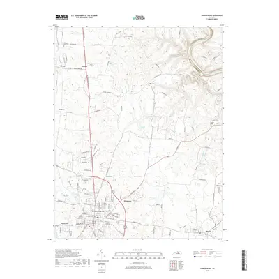
2019 Map of Harrodsburg
USGS Topo · Published 2019About this map
Harrodsburg sits at the heart of this Central Kentucky landscape, serving as a hub for a network of historic roads like Louisville Rd and Mundys Landing Rd. The terrain is defined by the winding course of the Kentucky River along the northeastern boundary, where the border between Woodford Co and Mercer Co follows the deep river valley. Significant local landmarks such as The Big Spring and Shawnee Springs highlight the karst topography of the region, which supported early settlement patterns evidenced by communities like McAfee and Talmage. For genealogists, the map preserves the locations of Spring Hill Cem and New Providence Cem, along with numerous family-named pikes and lanes including McCrosky Pike and Chinn Ln. The presence of the Kissing Bridge near Shaker Cr further illustrates the local character and infrastructure of this established agricultural and residential area.
Find a feature on this map
127 named features on this map. Tap any name to fly to it.
Don’t see what you’re looking for? This feature index may not catch every label — zoom into the map to look around manually.
Map Details
Editions of this 2019 Harrodsburg Map
This is the sole edition of this map. No revisions or reprints were ever made.
Other maps of this area

1905 · Harrodsburg
USGS Topo · 1:125,000

1950 · Bryantsville
USGS Topo · 1:24,000

1952 · Perryville
USGS Topo · 1:24,000

1952 · Keene
USGS Topo · 1:24,000

1952 · Danville
USGS Topo · 1:24,000

1952 · Harrodsburg
USGS Topo · 1:24,000

1952 · Cornishville
USGS Topo · 1:24,000

1952 · Bryantsville
USGS Topo · 1:24,000

1952 · Salvisa
USGS Topo · 1:24,000

1952 · Mc Brayer
USGS Topo · 1:24,000