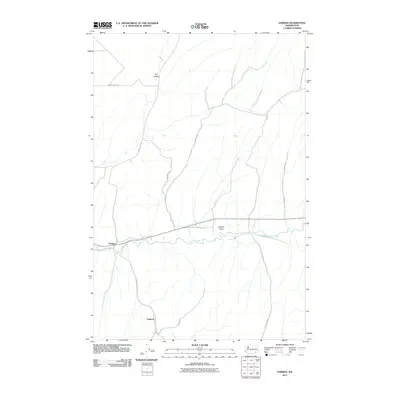
2011 Map of Harsha
USGS Topo · Published 2011About this map
The Touchet River meanders through the heart of the Touchet Valley, anchoring a landscape defined by its agricultural and riverine character. This Walla Walla County locale centers on the small settlement of Harsha along the riverbanks, with the rural community of Paddock situated to the south. The surrounding terrain is marked by distinct geographical features such as Dry Hollow in the northern reaches, while a network of rural roads, including Lyons Ferry Rd and Harvey-Shaw Rd, reflects the area's long-standing connection to regional transport and land management. The presence of roads like Pettyjohn Rd and Donnelly Rd suggests the historical footprint of local families who shaped this corner of southeastern Washington.
Find a feature on this map
16 named features on this map. Tap any name to fly to it.
Don’t see what you’re looking for? This feature index may not catch every label — zoom into the map to look around manually.
Map Details
Editions of this 2011 Harsha Map
This is the sole edition of this map. No revisions or reprints were ever made.
Other maps of this area

1915 · Wallulah
USGS Topo · 1:96,000

1918 · Wallula
USGS Topo · 1:125,000

1919 · Walla Walla
USGS Topo · 1:125,000

1921 · Walla Walla
USGS Topo · 1:125,000

1953 · Walla Walla
USGS Topo · 1:250,000

1958 · Walla Walla
USGS Topo · 1:250,000

1966 · Rulo
USGS Topo · 1:24,000

1966 · Hadley
USGS Topo · 1:24,000

1966 · Valley Grove
USGS Topo · 1:24,000
1966 · Eureka
USGS Topo · 1:24,000