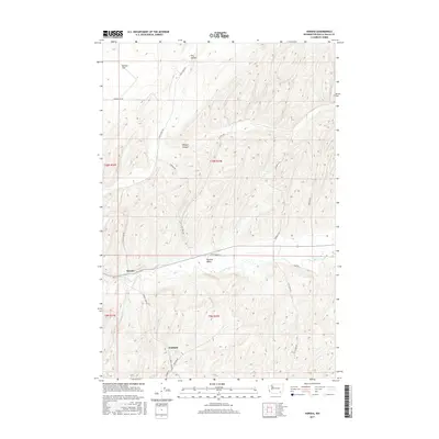
2017 Map of Harsha
USGS Topo · Published 2017About this map
Touchet Valley anchors this agricultural landscape in southeastern Washington, where the Touchet River winds through a corridor of cultivated fields and riparian terrain. The small settlements of Harsha and Paddock serve as focal points for the surrounding rural community, situated along a network of county roads that follow the natural contours of the land. High plateaus and recessed drainages define the geography, with features like Eureka Flat and Dry Hollow in the north giving way to the deeper incisions of Winnett Canyon.
Find a feature on this map
22 named features on this map. Tap any name to fly to it.
Don’t see what you’re looking for? This feature index may not catch every label — zoom into the map to look around manually.
Map Details
Editions of this 2017 Harsha Map
This is the sole edition of this map. No revisions or reprints were ever made.
Other maps of this area

1915 · Wallulah
USGS Topo · 1:96,000

1918 · Wallula
USGS Topo · 1:125,000

1919 · Walla Walla
USGS Topo · 1:125,000

1921 · Walla Walla
USGS Topo · 1:125,000

1953 · Walla Walla
USGS Topo · 1:250,000

1958 · Walla Walla
USGS Topo · 1:250,000

1966 · Rulo
USGS Topo · 1:24,000

1966 · Hadley
USGS Topo · 1:24,000

1966 · Valley Grove
USGS Topo · 1:24,000
1966 · Eureka
USGS Topo · 1:24,000