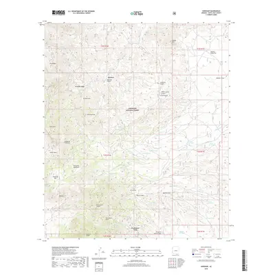
2018 Map of Harshaw
USGS Topo · Published 2018About this map
Harshaw and Trench Camp anchor this survey of the rugged highlands southeast of Patagonia, documenting a landscape defined by its mining heritage and seasonal water sources within the Coronado National Forest. The Patagonia Mountains dominate the western portion of the sheet, where peaks like American Peak rise above deep drainages such as Flux Canyon and Alum Gulch. The settlement pattern follows these natural corridors, with Harshaw Creek providing a lifeline through the center of the terrain. To the south, Washington Camp sits near the head of Washington Gulch, marking another cluster of human activity in this mineral-rich environment. The eastern half of the map transitions into the broader expanse of Meadow Valley, where numerous cattle tanks and springs—including Mowry Wash, Chino Tank, and Grennan Tank—illustrate the essential infrastructure for ranching in the arid Arizona borderlands.
Find a feature on this map
59 named features on this map. Tap any name to fly to it.
Don’t see what you’re looking for? This feature index may not catch every label — zoom into the map to look around manually.
Map Details
Editions of this 2018 Harshaw Map
This is the sole edition of this map. No revisions or reprints were ever made.
Other maps of this area

1904 · Patagonia
USGS Topo · 1:125,000

1905 · Patagonia
USGS Topo · 1:125,000

1905 · Nogales
USGS Topo · 1:125,000

1922 · Agus Caliente
USGS Topo · 1:62,500

1932 · Lochiel
USGS Topo · 1:62,500

1932 · Elgin
USGS Topo · 1:62,500

1933 · Calabasas
USGS Topo · 1:62,500

1940 · Elgin
USGS Topo · 1:62,500

1947 · Elgin
USGS Topo · 1:62,500

1948 · Canelo Pass
USGS Topo · 1:24,000