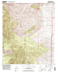
1996 Map of Harshaw
USGS Topo · Published 2003About this map
Mining operations and remote ranching outposts define the character of the Patagonia Mountains south of the San Rafael Valley. This landscape is a dense network of silver and lead extraction sites centered around the settlement of Harshaw. Major industrial landmarks like the Worlds Fair Mine, Hermosa Mine, and Mowry Mine are connected by rugged tracks winding through high peaks such as American Peak and Hermosa Hill.
Find a feature on this map
61 named features on this map. Tap any name to fly to it.
Don’t see what you’re looking for? This feature index may not catch every label — zoom into the map to look around manually.
Map Details
Editions of this 1996 Harshaw Map
This is the sole edition of this map. No revisions or reprints were ever made.
Other maps of this area

1904 · Patagonia
USGS Topo · 1:125,000

1905 · Patagonia
USGS Topo · 1:125,000

1905 · Nogales
USGS Topo · 1:125,000

1922 · Agus Caliente
USGS Topo · 1:62,500

1932 · Lochiel
USGS Topo · 1:62,500

1932 · Elgin
USGS Topo · 1:62,500

1933 · Calabasas
USGS Topo · 1:62,500

1940 · Elgin
USGS Topo · 1:62,500

1947 · Elgin
USGS Topo · 1:62,500

1948 · Canelo Pass
USGS Topo · 1:24,000