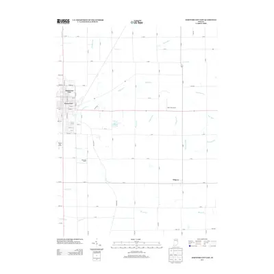
2013 Map of Hartford City East
USGS Topo · Published 2013About this map
Hartford City anchors the western edge of this Blackford County landscape, where residential streets like South Jefferson Street and East Main Street give way to an extensive network of managed waterways. This agricultural and drainage system is defined by numerous named features such as Whipple Ditch, Whitecotton Ditch, and DeBatty Prong, which support the rural acreage between the city and the settlement of Millgrove to the southeast.
Find a feature on this map
82 named features on this map. Tap any name to fly to it.
Don’t see what you’re looking for? This feature index may not catch every label — zoom into the map to look around manually.
Map Details
Editions of this 2013 Hartford City East Map
This is the sole edition of this map. No revisions or reprints were ever made.
Other maps of this area

1953 · Muncie
USGS Topo · 1:250,000

1956 · Muncie
USGS Topo · 1:250,000

1960 · Pennville
USGS Topo · 1:24,000

1960 · Hartford City East
USGS Topo · 1:24,000

1960 · Eaton
USGS Topo · 1:24,000

1960 · Wheeling
USGS Topo · 1:24,000
1960 · Redkey
USGS Topo · 1:24,000

1960 · Hartford City West
USGS Topo · 1:24,000

1962 · Montpelier
USGS Topo · 1:24,000

1962 · Roll
USGS Topo · 1:24,000