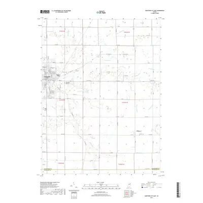
2019 Map of Hartford City East
USGS Topo · Published 2019About this map
Hartford City and the surrounding agricultural landscape of Blackford County are defined by a sophisticated network of drainage ditches and small creeks that support the region's productive farmland. The eastern edge of the city reaches toward Hoover Park and several historic burial grounds, including Greenlawn Cem and the Independent Order of Odd Fellows Cem. This survey illustrates the transition from urban residential blocks to the sprawling townships of t24n r10e and t23n r11e, where the small settlement of Millgrove sits at the intersection of Main St and Co Rd 300 S. The area is interlaced with water management features like Wentz Ditch and Whipple Ditch, which channel water toward Little Lick Cr and Big Lick Cr. Local aviation is represented by Hickory Hills Airport and Smith Field, marking the modernization of this traditional rural landscape.
Find a feature on this map
66 named features on this map. Tap any name to fly to it.
Don’t see what you’re looking for? This feature index may not catch every label — zoom into the map to look around manually.
Map Details
Editions of this 2019 Hartford City East Map
This is the sole edition of this map. No revisions or reprints were ever made.
Other maps of this area

1953 · Muncie
USGS Topo · 1:250,000

1956 · Muncie
USGS Topo · 1:250,000

1960 · Pennville
USGS Topo · 1:24,000

1960 · Hartford City East
USGS Topo · 1:24,000

1960 · Eaton
USGS Topo · 1:24,000

1960 · Wheeling
USGS Topo · 1:24,000
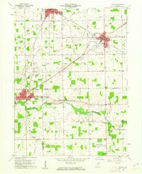
1960 · Redkey
USGS Topo · 1:24,000

1960 · Hartford City West
USGS Topo · 1:24,000

1962 · Montpelier
USGS Topo · 1:24,000

1962 · Roll
USGS Topo · 1:24,000