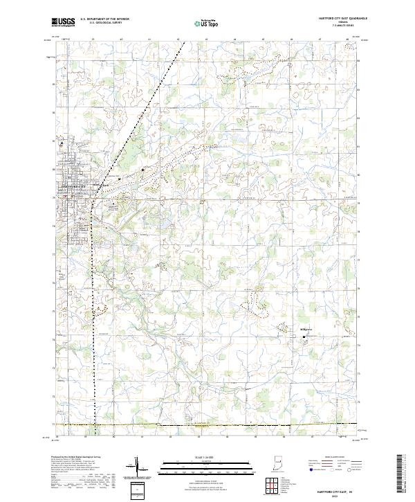
2022 Map of Hartford City East
USGS Topo · Published 2022About this map
The Blackford County Courthouse serves as the focal point of Hartford City, where a traditional Midwestern street grid gives way to an intricate network of agricultural drainage systems. The landscape is defined by its water management, featuring named channels such as Huggens Ditch, Wentz Ditch, and Whipple Ditch that crisscross the farmlands of t23n r10e and surrounding townships. These ditches facilitate the heavy cultivation of the plains surrounding the primary settlement and the smaller community of Millgrove to the southeast.
Find a feature on this map
107 named features on this map. Tap any name to fly to it.
Don’t see what you’re looking for? This feature index may not catch every label — zoom into the map to look around manually.
Map Details
Editions of this 2022 Hartford City East Map
This is the sole edition of this map. No revisions or reprints were ever made.
Other maps of this area

1953 · Muncie
USGS Topo · 1:250,000

1956 · Muncie
USGS Topo · 1:250,000

1960 · Pennville
USGS Topo · 1:24,000

1960 · Hartford City East
USGS Topo · 1:24,000

1960 · Eaton
USGS Topo · 1:24,000

1960 · Wheeling
USGS Topo · 1:24,000
1960 · Redkey
USGS Topo · 1:24,000

1960 · Hartford City West
USGS Topo · 1:24,000

1962 · Montpelier
USGS Topo · 1:24,000

1962 · Roll
USGS Topo · 1:24,000