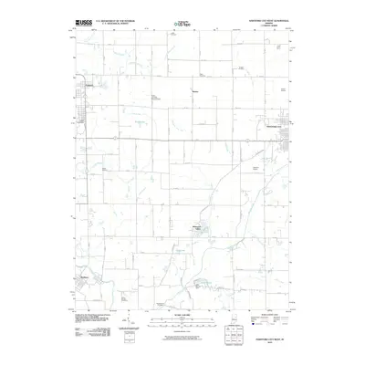
2010 Map of Hartford City West
USGS Topo · Published 2010About this map
The Taylor University campus and agricultural research sites like the Purdue University Memorial Farm anchor this Blackford County landscape as it appeared in the early 21st century. The terrain is defined by an intricate network of drainage systems, including Jefferson Ditch and Hollis Ditch, which support the region's productive farmland. The Mississinewa River winds through the southwest corner near Matthews, while water features like Shamrock Lakes and Lake Mohee, controlled by the Lake Mohee Dam, provide recreation and local water management.
Find a feature on this map
65 named features on this map. Tap any name to fly to it.
Don’t see what you’re looking for? This feature index may not catch every label — zoom into the map to look around manually.
Map Details
Editions of this 2010 Hartford City West Map
This is the sole edition of this map. No revisions or reprints were ever made.
Other maps of this area

1953 · Muncie
USGS Topo · 1:250,000

1956 · Muncie
USGS Topo · 1:250,000

1960 · Hartford City East
USGS Topo · 1:24,000

1960 · Eaton
USGS Topo · 1:24,000

1960 · Wheeling
USGS Topo · 1:24,000

1960 · Gas City
USGS Topo · 1:24,000

1960 · Gaston
USGS Topo · 1:24,000

1960 · Hartford City West
USGS Topo · 1:24,000

1962 · Montpelier
USGS Topo · 1:24,000

1962 · Roll
USGS Topo · 1:24,000