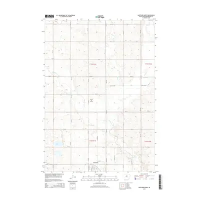
2015 Map of Hartford North
USGS Topo · Published 2015About this map
Hartford occupies the southern edge of this West Prairie landscape, where the town's residential grid meets the expansive agricultural plateaus of the Coteau des Prairies. This 2015 survey reveals a terrain defined by subtle elevation changes and natural drainage basins, most notably the meandering paths of Skunk Creek and its various tributaries including Colton Cr and the W Br Skunk Cr. The map captures a meticulously organized rural section-line road system, featuring family-named routes like Scotts Ave and Van Demark Ave that weave through the productive farmlands of Minnehaha County.
Find a feature on this map
37 named features on this map. Tap any name to fly to it.
Don’t see what you’re looking for? This feature index may not catch every label — zoom into the map to look around manually.
Map Details
Editions of this 2015 Hartford North Map
This is the sole edition of this map. No revisions or reprints were ever made.
Other maps of this area

1955 · Sioux Falls
USGS Topo · 1:250,000

1958 · Sioux Falls
USGS Topo · 1:250,000

1962 · Colton SE
USGS Topo · 1:24,000

1962 · Hartford South
USGS Topo · 1:24,000

1962 · Hartford North
USGS Topo · 1:24,000

1962 · Sioux Falls West
USGS Topo · 1:24,000

1962 · Crooks
USGS Topo · 1:24,000

1964 · Grass Lake
USGS Topo · 1:24,000

1964 · Humboldt
USGS Topo · 1:24,000
1968 · Colton
USGS Topo · 1:24,000