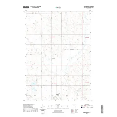
2017 Map of Hartford North
USGS Topo · Published 2017About this map
Hartford occupies the southern edge of this map, serving as a gateway to the agricultural highlands of the Coteau des Prairies. This landform, characterized by its elevated plateau and glacial legacy, dictates the drainage patterns for the winding Skunk Creek and its tributaries, including Colton Cr and W Br Skunk Cr. The map reveals a highly structured rural landscape defined by a precise grid of section lines and township roads such as 464th Ave and 252nd St.
Find a feature on this map
41 named features on this map. Tap any name to fly to it.
Don’t see what you’re looking for? This feature index may not catch every label — zoom into the map to look around manually.
Map Details
Editions of this 2017 Hartford North Map
This is the sole edition of this map. No revisions or reprints were ever made.
Other maps of this area

1955 · Sioux Falls
USGS Topo · 1:250,000

1958 · Sioux Falls
USGS Topo · 1:250,000

1962 · Colton SE
USGS Topo · 1:24,000

1962 · Hartford South
USGS Topo · 1:24,000

1962 · Hartford North
USGS Topo · 1:24,000

1962 · Sioux Falls West
USGS Topo · 1:24,000

1962 · Crooks
USGS Topo · 1:24,000

1964 · Grass Lake
USGS Topo · 1:24,000

1964 · Humboldt
USGS Topo · 1:24,000
1968 · Colton
USGS Topo · 1:24,000