
2021 Map of Hartford North
USGS Topo · Published 2021About this map
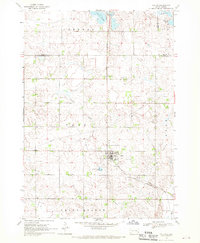
The glacial highlands of the Coteau des Prairies dominate this Minnehaha County landscape, where the northern edge of Hartford meets a sprawling agricultural grid. This survey captures a specific drainage pattern defined by Skunk Cr and the W Br Skunk Cr, watercourses that have shaped the development of the region's farms and transport corridors. The southern margin of the sheet reveals the town's residential growth along N Main Ave and N Oaks Ave, providing a detailed view of the community just north of the Interstate corridor. Notable water features like Scotts Slough and Colton Cr break the geometric precision of the township roads, marking the natural lowlands within this elevated plateau. Local researchers can trace the modern layout of suburban developments such as those near Grand View Meadow St against the historical section lines of the Public Land Survey System.
Find a feature on this map
40 named features on this map. Tap any name to fly to it.
Don’t see what you’re looking for? This feature index may not catch every label — zoom into the map to look around manually.
Map Details
Editions of this 2021 Hartford North Map
This is the sole edition of this map. No revisions or reprints were ever made.
Other maps of this area

1955 · Sioux Falls
USGS Topo · 1:250,000

1958 · Sioux Falls
USGS Topo · 1:250,000

1962 · Colton SE
USGS Topo · 1:24,000

1962 · Hartford South
USGS Topo · 1:24,000

1962 · Hartford North
USGS Topo · 1:24,000

1962 · Sioux Falls West
USGS Topo · 1:24,000

1962 · Crooks
USGS Topo · 1:24,000

1964 · Grass Lake
USGS Topo · 1:24,000

1964 · Humboldt
USGS Topo · 1:24,000
1968 · Colton
USGS Topo · 1:24,000