
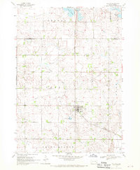
1962 Map of Hartford North
USGS Topo · Published 1964About this map
Hartford sits at the southern edge of this prairie landscape, where the iron of the Chicago and North Western railroad cuts across the glacial terrain of Minnehaha County. The survey reveals a highly organized rural infrastructure in the early 1960s, defined by its township structure in Grand Meadow, Lyons, and Benton. This era was characterized by the persistence of the small-scale country school system, with several still-functioning education centers such as School No 91, Ginsbach Sch, and McLeod Sch serving the surrounding farmsteads.
Find a feature on this map
13 named features on this map. Tap any name to fly to it.
Don’t see what you’re looking for? This feature index may not catch every label — zoom into the map to look around manually.
Map Details
Editions of this 1962 Hartford North Map
This is the sole edition of this map. No revisions or reprints were ever made.
Other maps of this area

1955 · Sioux Falls
USGS Topo · 1:250,000

1958 · Sioux Falls
USGS Topo · 1:250,000

1962 · Colton SE
USGS Topo · 1:24,000

1962 · Hartford South
USGS Topo · 1:24,000

1962 · Sioux Falls West
USGS Topo · 1:24,000

1962 · Crooks
USGS Topo · 1:24,000

1964 · Grass Lake
USGS Topo · 1:24,000

1964 · Humboldt
USGS Topo · 1:24,000
1968 · Colton
USGS Topo · 1:24,000
1968 · Buffalo Trading Post
USGS Topo · 1:24,000