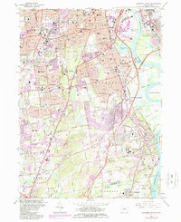
1964 Map of Hartford South
USGS Topo · Published 1985About this map
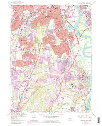
The Connecticut River serves as the eastern boundary of this mid-century landscape, framing a dense network of suburban development and civic infrastructure south of Hartford. The terrain is defined by the prominent ridge of Cedar Mountain, which overlooks a transition from the industrial and aviation activity at Hartford-Brainard Airport to the institutional complexes of Rocky Hill. The map documents a significant concentration of public service sites, including the State Veterans Home and Hospital and the State Institute for Blind, alongside extensive green spaces like Goodwin Park and the expansive Cedar Hill Cemetery.
Find a feature on this map
77 named features on this map. Tap any name to fly to it.
Don’t see what you’re looking for? This feature index may not catch every label — zoom into the map to look around manually.
Map Details
Editions of this 1964 Hartford South Map
5 editions found
Other maps of this area

1892 · Hartford
USGS Topo · 1:62,500

1892 · Meriden
USGS Topo · 1:62,500

1892 · Granby
USGS Topo · 1:62,500

1893 · Middletown
USGS Topo · 1:62,500

1893 · Meriden
USGS Topo · 1:62,500

1906 · Farmington
USGS Topo · 1:125,000

1928 · Cromwell
USGS Topo · 1:24,000

1928 · Windsor
USGS Topo · 1:24,000

1928 · Glastonbury
USGS Topo · 1:24,000

1928 · Manchester
USGS Topo · 1:24,000