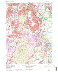
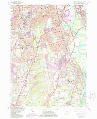
1964 Map of Hartford South
USGS Topo · Published 1992About this map
Cedar Mountain stands as a prominent topographical divider between the industrializing suburbs of Newington and the ancient riverfront settlements of Wethersfield. This 1964 survey, revised into the early 1990s, documents a landscape dense with institutional history, from the sprawling grounds of Cedar Hill Cemetery to the VA Hospital and the Cedarcrest State Sanatorium. The core of Hartford transitions into the southern reaches of Rocky Hill, where Dinosaur State Park preserves the region's prehistoric heritage alongside the modern aviation of Hartford-Brainard Airport.
Find a feature on this map
124 named features on this map. Tap any name to fly to it.
Don’t see what you’re looking for? This feature index may not catch every label — zoom into the map to look around manually.
Map Details
Editions of this 1964 Hartford South Map
5 editions found
Other maps of this area

1892 · Hartford
USGS Topo · 1:62,500

1892 · Meriden
USGS Topo · 1:62,500

1892 · Granby
USGS Topo · 1:62,500

1893 · Middletown
USGS Topo · 1:62,500

1893 · Meriden
USGS Topo · 1:62,500

1906 · Farmington
USGS Topo · 1:125,000

1928 · Cromwell
USGS Topo · 1:24,000

1928 · Windsor
USGS Topo · 1:24,000

1928 · Glastonbury
USGS Topo · 1:24,000

1928 · Manchester
USGS Topo · 1:24,000