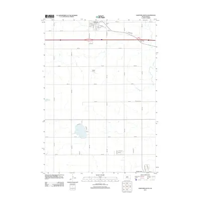
2012 Map of Hartford South
USGS Topo · Published 2012About this map
Hartford serves as the primary hub in this early 21st-century portrait of Minnehaha County, where the grid-based agricultural layout of the Great Plains meets expanding residential pockets. The town's religious and local history is anchored by Saint George Cem and Hartford Cem, while its modern connection to the wider region is defined by the high-speed transit corridor passing through Buffalo Ridge. To the south, the landscape shifts toward recreation and specialized land use at Wall Lake and the nearby Penitentiary Farms. Small aviation and natural drainage patterns are preserved here, visible in the footprint of the Oakleaf Airport and the wandering paths of Skunk Cr and Beaver Cr. The transition from rural sections to planned communities is evident at Country Acres, illustrating the suburban growth pressing outward from the regional centers during this era.
Find a feature on this map
46 named features on this map. Tap any name to fly to it.
Don’t see what you’re looking for? This feature index may not catch every label — zoom into the map to look around manually.
Map Details
Editions of this 2012 Hartford South Map
This is the sole edition of this map. No revisions or reprints were ever made.
Other maps of this area

1897 · Canton
USGS Topo · 1:125,000

1898 · Parker
USGS Topo · 1:125,000

1900 · Canton
USGS Topo · 1:125,000

1955 · Sioux Falls
USGS Topo · 1:250,000

1958 · Sioux Falls
USGS Topo · 1:250,000

1962 · Tea
USGS Topo · 1:24,000

1962 · Hartford South
USGS Topo · 1:24,000

1962 · Lennox NW
USGS Topo · 1:24,000

1962 · Hartford North
USGS Topo · 1:24,000

1962 · Sioux Falls West
USGS Topo · 1:24,000