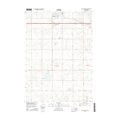
2015 Map of Hartford South
USGS Topo · Published 2015About this map
Hartford serves as the northern anchor of this landscape on the edge of the Coteau des Prairies, a vast plateau rising above the surrounding plains. The 2015 survey reveals a pattern of section-line roads and residential developments, particularly clustered near the recreation hub of Wall Lake. This water body is bordered by local access points like W Shore Pl, contrasting with the more natural state of Fensterman Slough and Skunk Cr to the east. Local heritage is preserved at the Hartford Cem and Saint George Cem, while the Oakleaf Airport highlights the region's modern aviation infrastructure. The map illustrates a transitional zone where established agricultural township layouts meet newer rural-residential corridors like Country Ln and Inca Dr.
Find a feature on this map
28 named features on this map. Tap any name to fly to it.
Don’t see what you’re looking for? This feature index may not catch every label — zoom into the map to look around manually.
Map Details
Editions of this 2015 Hartford South Map
This is the sole edition of this map. No revisions or reprints were ever made.
Other maps of this area

1897 · Canton
USGS Topo · 1:125,000

1898 · Parker
USGS Topo · 1:125,000

1900 · Canton
USGS Topo · 1:125,000

1955 · Sioux Falls
USGS Topo · 1:250,000

1958 · Sioux Falls
USGS Topo · 1:250,000

1962 · Tea
USGS Topo · 1:24,000

1962 · Hartford South
USGS Topo · 1:24,000

1962 · Lennox NW
USGS Topo · 1:24,000

1962 · Hartford North
USGS Topo · 1:24,000

1962 · Sioux Falls West
USGS Topo · 1:24,000