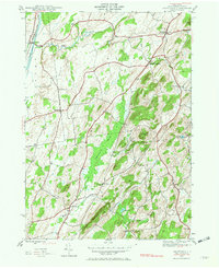
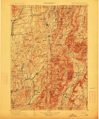
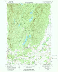
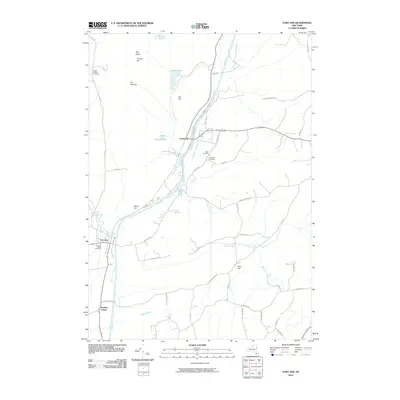
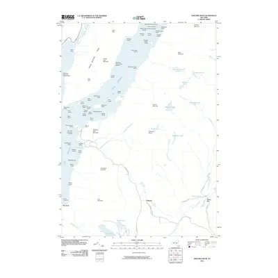
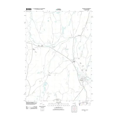
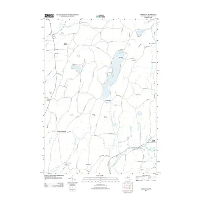
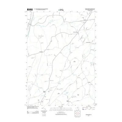
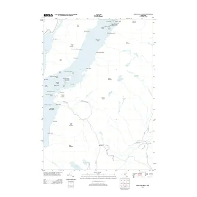
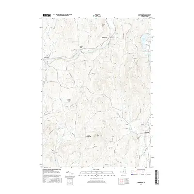
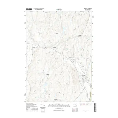
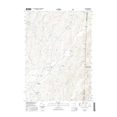
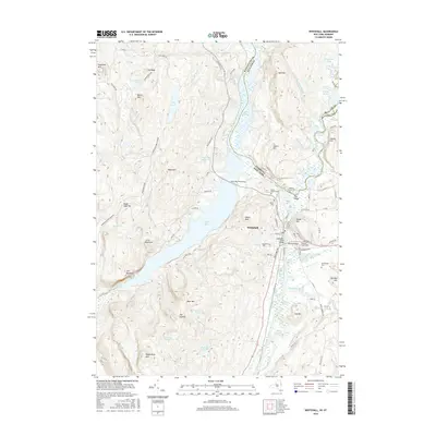
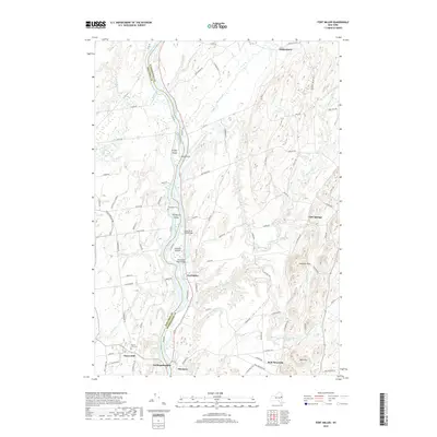
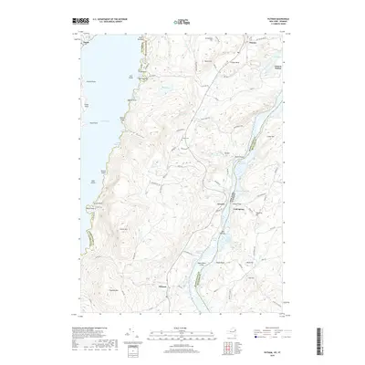
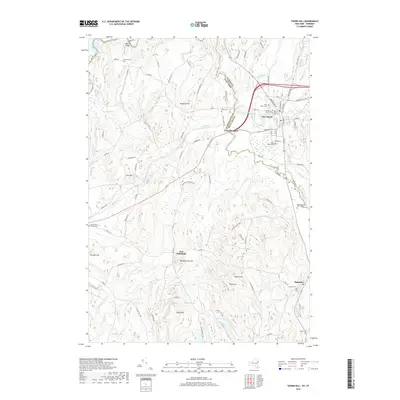
1944 Map of Hartford
USGS Topo · Published 1967About this map
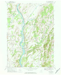
Champlain Canal and the Hudson and Delaware Canal run parallel through the northwestern corner of this Washington County landscape, marking the historic transportation corridor near Smiths Basin. The terrain is defined by a series of north-south ridges, including Ladd Mountain and Black Mtn, which frame the low-lying Tamarack Swamp. This mid-century survey illustrates the rural character of the area, where small clusters of settlement like Adamsville and South Hartford are connected by a network of winding roads.
Find a feature on this map
27 named features on this map. Tap any name to fly to it.
Don’t see what you’re looking for? This feature index may not catch every label — zoom into the map to look around manually.
Map Details
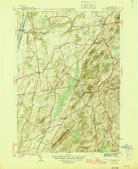
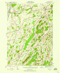
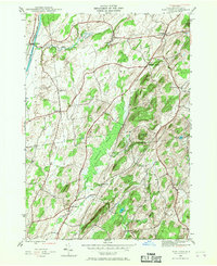
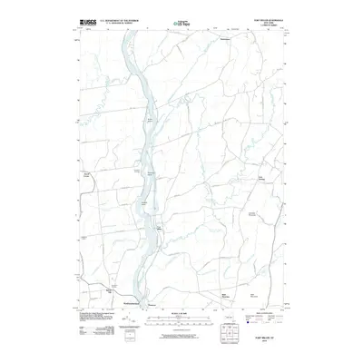
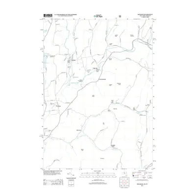
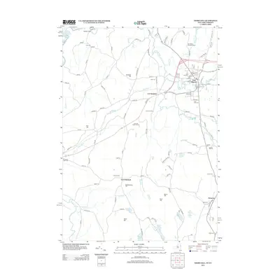
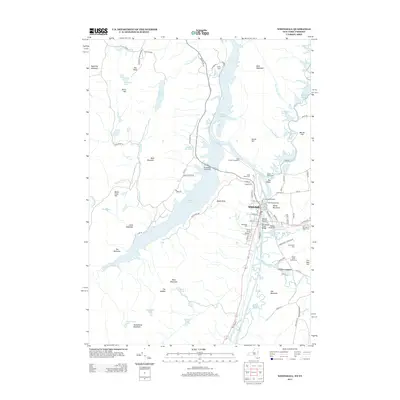
Editions of this 1944 Hartford Map
4 editions found
Historical Maps of Kingsbury Through Time
108 maps found

1893 Fort Ann
Washington County, NY

1893 Whitehall
Washington County, NY

1895 Cambridge
Washington County, NY

1895 Fort Ann
Washington County, NY

1895 Whitehall
Washington County, NY

1898 Cambridge
Washington County, NY

1898 Fort Ann
Washington County, NY

1898 Whitehall
Washington County, NY

1901 Cambridge
Washington County, NY

1901 Fort Ann
Washington County, NY

1902 Whitehall
Washington County, NY
1903 Mettawee
Washington County, NY

1904 Fort Ann
Washington County, NY

1935 Fort Miller
Washington County, NY

1944 Cambridge
Washington County, NY

1944 Cossayuna
Washington County, NY
1944 Fort Ann
Washington County, NY
1944 Granville
Washington County, NY
1944 Hartford
Washington County, NY
1944 Salem
Washington County, NY

1944 Shushan
Washington County, NY

1946 Cambridge
Washington County, NY

1946 Cossayuna
Washington County, NY

1946 Fort Ann
Washington County, NY

1946 Granville
Washington County, NY

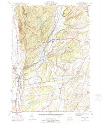
1946 Hartford
Washington County, NY

1946 Salem
Washington County, NY

1946 Shushan
Washington County, NY

1946 Thorn Hill
Washington County, NY

1947 Fort Ann
Washington County, NY

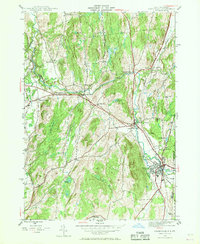
1947 Hartford
Washington County, NY

1947 Shushan
Washington County, NY

1948 Thorn Hill
Washington County, NY

1950 Putnam
Washington County, NY

1950 Salem
Washington County, NY

1950 Whitehall
Washington County, NY

1950 Whitehall
Washington County, NY

1951 Cossayuna
Washington County, NY
1966 Putnam Mountain
Washington County, NY

1966 Shelving Rock
Washington County, NY
1967 Ft Miller
Washington County, NY

1995 Salem
Washington County, NY

1995 Shushan
Washington County, NY
2010 Cambridge
Washington County, NY
2010 Cossayuna
Washington County, NY
2010 Fort Ann
Washington County, NY
2010 Fort Miller
Washington County, NY
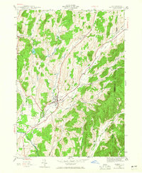
2010 Hartford
Washington County, NY
2010 Putnam Mountain
Washington County, NY
2010 Shelving Rock
Washington County, NY
2011 Salem
Washington County, NY
2011 Shushan
Washington County, NY
2011 Whitehall
Washington County, NY
2012 Granville
Washington County, NY
2012 Putnam
Washington County, NY
2012 Thorn Hill
Washington County, NY
2013 Cambridge
Washington County, NY
2013 Cossayuna
Washington County, NY
2013 Fort Ann
Washington County, NY
2013 Fort Miller
Washington County, NY
2013 Granville
Washington County, NY
2013 Hartford
Washington County, NY
2013 Putnam Mountain
Washington County, NY
2013 Putnam
Washington County, NY
2013 Salem
Washington County, NY
2013 Shelving Rock
Washington County, NY
2013 Shushan
Washington County, NY
2013 Thorn Hill
Washington County, NY
2013 Whitehall
Washington County, NY
2016 Cambridge
Washington County, NY
2016 Cossayuna
Washington County, NY
2016 Fort Ann
Washington County, NY
2016 Fort Miller
Washington County, NY
2016 Granville
Washington County, NY
2016 Hartford
Washington County, NY
2016 Putnam Mountain
Washington County, NY
2016 Putnam
Washington County, NY
2016 Salem
Washington County, NY
2016 Shelving Rock
Washington County, NY
2016 Shushan
Washington County, NY
2016 Thorn Hill
Washington County, NY
2016 Whitehall
Washington County, NY
2019 Cambridge
Washington County, NY
2019 Cossayuna
Washington County, NY
2019 Fort Ann
Washington County, NY
2019 Fort Miller
Washington County, NY
2019 Granville
Washington County, NY
2019 Hartford
Washington County, NY
2019 Putnam Mountain
Washington County, NY
2019 Putnam
Washington County, NY
2019 Salem
Washington County, NY
2019 Shelving Rock
Washington County, NY
2019 Shushan
Washington County, NY
2019 Thorn Hill
Washington County, NY
2019 Whitehall
Washington County, NY

2023 Cambridge
Washington County, NY

2023 Cossayuna
Washington County, NY

2023 Fort Ann
Washington County, NY

2023 Fort Miller
Washington County, NY

2023 Granville
Washington County, NY

2023 Hartford
Washington County, NY

2023 Putnam Mountain
Washington County, NY

2023 Putnam
Washington County, NY

2023 Salem
Washington County, NY

2023 Shelving Rock
Washington County, NY

2023 Shushan
Washington County, NY

2023 Thorn Hill
Washington County, NY

2023 Whitehall
Washington County, NY