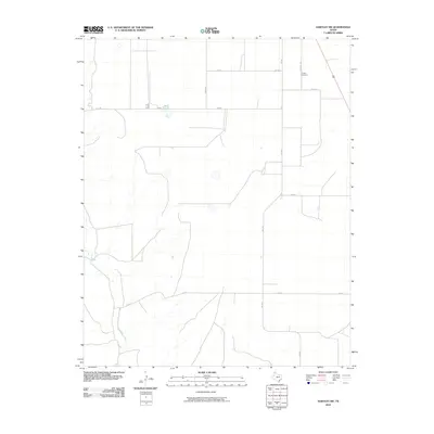
2010 Map of Hartley SW
USGS Topo · Published 2010About this map
Rita Blanca Creek cuts a winding path through the High Plains of the Texas Panhandle in this 2010 survey of Hartley County. The landscape is defined by a rigid grid of rural infrastructure, where long stretches of Fm 998 and Fm 2357 connect isolated ranching and agricultural tracts. This network of section roads provides a clear look at the modern land division in the region, centered around the local landmark of Hartley Cemetery, located along the aptly named Cemetery Rd. The topography is relatively flat, typical of the Llano Estacado, with subtle drainage patterns influencing the placement of the sparse road network. These features illustrate the enduring cattle-country character of the area, where water sources like the creek remain vital to the local geography even as paved roads have modernized the travel corridors between settlements.
Find a feature on this map
10 named features on this map. Tap any name to fly to it.
Don’t see what you’re looking for? This feature index may not catch every label — zoom into the map to look around manually.
Map Details
Editions of this 2010 Hartley SW Map
This is the sole edition of this map. No revisions or reprints were ever made.
Other maps of this area

1954 · Tucumcari
USGS Topo · 1:250,000

1958 · Tucumcari
USGS Topo · 1:250,000

1963 · Hartley SE
USGS Topo · 1:24,000

1963 · Hartley NE
USGS Topo · 1:24,000

1971 · Proctor Ranch
USGS Topo · 1:24,000

1971 · Channing NW
USGS Topo · 1:24,000
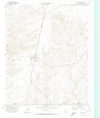
1971 · Channing
USGS Topo · 1:24,000

1972 · Hartley SW
USGS Topo · 1:24,000

1973 · Pardue Camp
USGS Topo · 1:24,000

1973 · Hartley
USGS Topo · 1:24,000