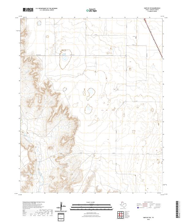
2022 Map of Hartley SW
USGS Topo · Published 2022About this map
Rita Blanca Cr carves a distinct path through the High Plains landscape of Hartley County in this 2022 survey. This portion of the Texas Panhandle is defined by its expansive ranching territory and the grid of rural infrastructure that supports it. Local roads like Co Rd N and Ranch Rd 998 cross the terrain, illustrating the modern management of these large landholdings. For those researching family history in the region, the Hartley Cem remains a primary landmark for the community, situated near the intersection of Co Rd O and Co Rd 38. The map demonstrates the persistent importance of water sources in this arid environment, with the creek bed serving as the dominant geographic feature amid a network of farm-to-market roads such as FM 2357.
Find a feature on this map
13 named features on this map. Tap any name to fly to it.
Don’t see what you’re looking for? This feature index may not catch every label — zoom into the map to look around manually.
Map Details
Editions of this 2022 Hartley SW Map
This is the sole edition of this map. No revisions or reprints were ever made.
Other maps of this area

1954 · Tucumcari
USGS Topo · 1:250,000

1958 · Tucumcari
USGS Topo · 1:250,000

1963 · Hartley SE
USGS Topo · 1:24,000

1963 · Hartley NE
USGS Topo · 1:24,000

1971 · Proctor Ranch
USGS Topo · 1:24,000

1971 · Channing NW
USGS Topo · 1:24,000
1971 · Channing
USGS Topo · 1:24,000

1972 · Hartley SW
USGS Topo · 1:24,000

1973 · Pardue Camp
USGS Topo · 1:24,000

1973 · Hartley
USGS Topo · 1:24,000