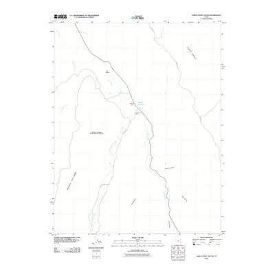
2011 Map of Harts Point South
USGS Topo · Published 2011About this map
Dugout Ranch serves as a focal point for activity in this part of San Juan County, situated along the winding course of Indian Creek. This 2011 survey captures a landscape defined by significant topographic relief and protected lands, most notably the Bridger Jack Mesa Outstanding Natural Area which dominates the western half of the sheet. The map documents the vital water management infrastructure of the arid region, including Dugout Dam and Dugout Reservoir. Primary access is provided by Beef Basin Rd and Hart Point Rd, which traverse the high ground of Harts Point and lead toward prominent formations like The Island. Deep drainage systems including Donnelly Canyon, Titus Canyon, and Hog Canyon illustrate the complex erosional patterns that characterize the area's geography.
Find a feature on this map
17 named features on this map. Tap any name to fly to it.
Don’t see what you’re looking for? This feature index may not catch every label — zoom into the map to look around manually.
Map Details
Editions of this 2011 Harts Point South Map
This is the sole edition of this map. No revisions or reprints were ever made.
Other maps of this area

1885 · La Sal
USGS Topo · 1:250,000

1886 · Abajo
USGS Topo · 1:250,000

1892 · Abajo
USGS Topo · 1:250,000

1893 · Abajo
USGS Topo · 1:250,000

1935 · Elk Ridge
USGS Topo · 1:96,000

1940 · Elk Ridge
USGS Topo · 1:125,000

1954 · Elk Ridge 1 NW
USGS Topo · 1:24,000

1954 · Elk Ridge 1 NE
USGS Topo · 1:24,000

1954 · Carlisle 4 SW
USGS Topo · 1:24,000

1954 · Mt Peale 3 NW
USGS Topo · 1:24,000