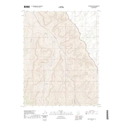
2023 Map of Harts Point South
USGS Topo · Published 2023About this map
Bridger Jack Mesa and Harts Point dominate this high-desert landscape in San Juan County, where complex drainage systems and plateau formations define the area. The map illustrates a network of deep incisions including Donnelly Canyon, Shay Canyon, and Titus Canyon, all feeding into the prominent Indian Creek corridor. This particular quadrangle is notable for its concentration of named backcountry routes such as Beef Basin Rd and Bridger Jack Rd, which navigate the difficult terrain alongside Federal Rte 2444. To the west, Lavender Canyon and Lavender Creek reveal the intricate topography of the canyonlands, while The Island stands as a distinct geological feature above the creek bed. The detail of the 2023 survey provides essential context for modern land use and historical transit across these mesas.
Find a feature on this map
16 named features on this map. Tap any name to fly to it.
Don’t see what you’re looking for? This feature index may not catch every label — zoom into the map to look around manually.
Map Details
Editions of this 2023 Harts Point South Map
This is the sole edition of this map. No revisions or reprints were ever made.
Other maps of this area

1885 · La Sal
USGS Topo · 1:250,000

1886 · Abajo
USGS Topo · 1:250,000

1892 · Abajo
USGS Topo · 1:250,000

1893 · Abajo
USGS Topo · 1:250,000

1935 · Elk Ridge
USGS Topo · 1:96,000

1940 · Elk Ridge
USGS Topo · 1:125,000

1954 · Elk Ridge 1 NW
USGS Topo · 1:24,000

1954 · Elk Ridge 1 NE
USGS Topo · 1:24,000

1954 · Carlisle 4 SW
USGS Topo · 1:24,000

1954 · Mt Peale 3 NW
USGS Topo · 1:24,000