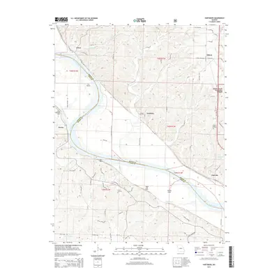
2015 Map of Hartsburg
USGS Topo · Published 2015About this map
The Missouri River carves a winding path through the borderlands of Boone and Cole Counties, defining the agricultural and cultural geography of this region. Hartsburg serves as a central hub for the surrounding fertile lowlands, where the Katy Trl now follows the path of former rail commerce. The landscape is dotted with small, historical communities like Wilton, Oldham, and Claysville, each situated along the river or the bluff lines. To the east, the terrain rises into the timbered ridges of the Mark Twain National Forest. The map provides significant genealogical value through the documentation of local burial sites, including Friedens Cemetery, Mount Pleasant Cemetery, and Steeley Cemetery. Distinctive river landmarks such as Little Manitou Rock, Bull Rock, and Sugar Loaf Rock serve as enduring navigational points along the river valley's limestone bluffs.
Find a feature on this map
80 named features on this map. Tap any name to fly to it.
Don’t see what you’re looking for? This feature index may not catch every label — zoom into the map to look around manually.
Map Details
Editions of this 2015 Hartsburg Map
This is the sole edition of this map. No revisions or reprints were ever made.
Other maps of this area

1886 · Jefferson City
USGS Topo · 1:125,000

1894 · Jefferson City
USGS Topo · 1:125,000

1939 · Jefferson City
USGS Topo · 1:24,000

1939 · Jefferson City
USGS Topo · 1:62,500

1942 · Jefferson City
USGS Topo · 1:62,500

1944 · Millersburg
USGS Topo · 1:62,500

1946 · Millersburg
USGS Topo · 1:62,500

1947 · Jefferson City
USGS Topo · 1:250,000

1948 · Centertown
USGS Topo · 1:62,500

1948 · Columbia
USGS Topo · 1:62,500