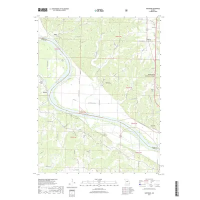
2017 Map of Hartsburg
USGS Topo · Published 2017About this map
Hartsburg and its surrounding river bottoms occupy a prominent position along the Missouri River in this 2017 survey of the border between Boone and Cole counties. The landscape is defined by the sharp transition from the broad, silty floodplain to the dissected bluffs of the Mark Twain National Forest. Local history and geography are marked by prominent geological features such as Little Manitou Rock and Sugar Loaf Rock, alongside islands like Fox Island and Stanley Island. Small communities including Wilton, Marion, and Claysville follow the river’s path, while family and community roots are preserved at Friedens Cem and Mount Pleasant Cem. The map provides a contemporary view of the region's rural road network, including Old Hwy 179 and State Hwy A, which connect these riverfront settlements to the interior upland terrain.
Find a feature on this map
80 named features on this map. Tap any name to fly to it.
Don’t see what you’re looking for? This feature index may not catch every label — zoom into the map to look around manually.
Map Details
Editions of this 2017 Hartsburg Map
This is the sole edition of this map. No revisions or reprints were ever made.
Other maps of this area

1886 · Jefferson City
USGS Topo · 1:125,000

1894 · Jefferson City
USGS Topo · 1:125,000

1939 · Jefferson City
USGS Topo · 1:24,000

1939 · Jefferson City
USGS Topo · 1:62,500

1942 · Jefferson City
USGS Topo · 1:62,500

1944 · Millersburg
USGS Topo · 1:62,500

1946 · Millersburg
USGS Topo · 1:62,500

1947 · Jefferson City
USGS Topo · 1:250,000

1948 · Centertown
USGS Topo · 1:62,500

1948 · Columbia
USGS Topo · 1:62,500