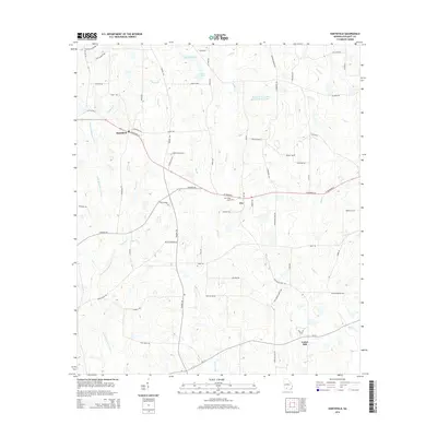
2014 Map of Hartsfield
USGS Topo · Published 2014About this map
The Little Ochlockonee River defines the western reaches of this Colquitt County landscape, where the rural settlements of Hartsfield and Bay anchor a network of agricultural roads and creeks. The terrain is a complex drainage system of small waterways, including Watery Br, Piney Br, and the elongated Bridge Cr which feeds into the Bridge Cr Structure Number 83 Lake. Local history is centered around quiet landmarks like the Bridge Creek Cem and the southern crossroad of Center Hill. Long-established family names appear on transit routes such as Thigpen Trl, Faison Rd, and Dalton Gay Rd. The survey highlights a period of steady rural continuity, where the land is divided by traditional property lines and irrigation sources like Moss Lake and Moss Lake N that support the region's agricultural character.
Find a feature on this map
69 named features on this map. Tap any name to fly to it.
Don’t see what you’re looking for? This feature index may not catch every label — zoom into the map to look around manually.
Map Details
Editions of this 2014 Hartsfield Map
This is the sole edition of this map. No revisions or reprints were ever made.
Other maps of this area

1953 · Dothan
USGS Topo · 1:250,000

1953 · Waycross
USGS Topo · 1:250,000

1954 · Dothan
USGS Topo · 1:250,000

1955 · Dothan
USGS Topo · 1:250,000

1956 · Baconton
USGS Topo · 1:62,500

1956 · Doerun
USGS Topo · 1:62,500

1958 · Waycross
USGS Topo · 1:250,000

1971 · Meigs
USGS Topo · 1:24,000

1971 · Cotton
USGS Topo · 1:24,000
1974 · Doerun
USGS Topo · 1:24,000