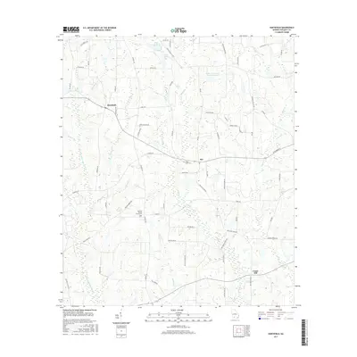
2017 Map of Hartsfield
USGS Topo · Published 2017About this map
Hartsfield and the surrounding agricultural landscapes of Colquitt County are defined by an intricate network of waterways and rural corridors. The Little Ochlockonee River flows through the western portion of the area, joined by numerous tributaries including Slocumb Br and Thigpen Br. This 2017 survey reveals the established settlement patterns of communities like Bay and Center Hill, where life is anchored by local institutions such as Rose Hill Baptist Church and its accompanying Rose Hill Baptist Cem.
Find a feature on this map
68 named features on this map. Tap any name to fly to it.
Don’t see what you’re looking for? This feature index may not catch every label — zoom into the map to look around manually.
Map Details
Editions of this 2017 Hartsfield Map
This is the sole edition of this map. No revisions or reprints were ever made.
Other maps of this area

1953 · Dothan
USGS Topo · 1:250,000

1953 · Waycross
USGS Topo · 1:250,000

1954 · Dothan
USGS Topo · 1:250,000

1955 · Dothan
USGS Topo · 1:250,000

1956 · Baconton
USGS Topo · 1:62,500

1956 · Doerun
USGS Topo · 1:62,500

1958 · Waycross
USGS Topo · 1:250,000

1971 · Meigs
USGS Topo · 1:24,000

1971 · Cotton
USGS Topo · 1:24,000
1974 · Doerun
USGS Topo · 1:24,000