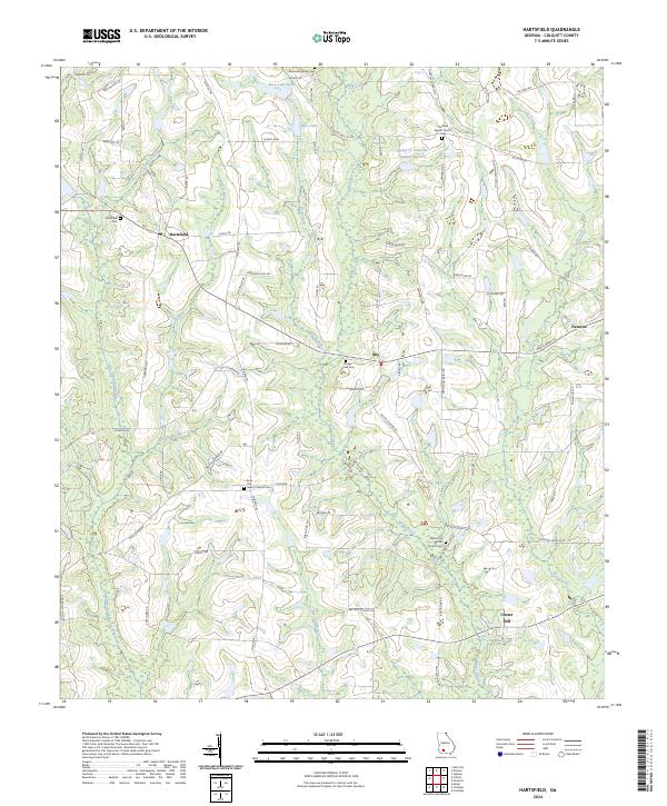
2024 Map of Hartsfield
USGS Topo · Published 2024About this map
The Little Ochlockonee River defines the western edge of this agricultural landscape in Colquitt County, where established rural communities and family legacies are marked by numerous landmarks. Small-scale farming and timber interests are visible through the network of drainage basins like Watery Branch and Bay Pole Branch that feed into the larger river system. The map highlights the social fabric of the area through its congregational centers, including Rose Hill Baptist Church and Oak Grove Baptist Church, each accompanied by their respective cemeteries.
Find a feature on this map
76 named features on this map. Tap any name to fly to it.
Don’t see what you’re looking for? This feature index may not catch every label — zoom into the map to look around manually.
Map Details
Editions of this 2024 Hartsfield Map
This is the sole edition of this map. No revisions or reprints were ever made.
Other maps of this area

1953 · Dothan
USGS Topo · 1:250,000

1953 · Waycross
USGS Topo · 1:250,000

1954 · Dothan
USGS Topo · 1:250,000

1955 · Dothan
USGS Topo · 1:250,000

1956 · Baconton
USGS Topo · 1:62,500

1956 · Doerun
USGS Topo · 1:62,500

1958 · Waycross
USGS Topo · 1:250,000

1971 · Meigs
USGS Topo · 1:24,000

1971 · Cotton
USGS Topo · 1:24,000
1974 · Doerun
USGS Topo · 1:24,000