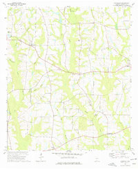
1974 Map of Hartsfield
USGS Topo · Published 1977About this map
The Ochlockonee River defines the southwestern drainage of this rural South Georgia landscape, where agricultural tradition and small-town junctions shaped the mid-1970s character of Colquitt County. Small community centers like Hartsfield and Funston serve as anchors for a network of winding country roads and creek branches, including Thigpen Branch and Watery Branch. The map reveals a high density of rural religious life, with numerous landmarks such as Sinners Friend Ch, Bethany Ch, and Rose Hill Ch scattered across the township, often situated near family-named waters like Mims Millpond.
Find a feature on this map
27 named features on this map. Tap any name to fly to it.
Don’t see what you’re looking for? This feature index may not catch every label — zoom into the map to look around manually.
Map Details
Editions of this 1974 Hartsfield Map
This is the sole edition of this map. No revisions or reprints were ever made.
Other maps of this area

1953 · Dothan
USGS Topo · 1:250,000

1953 · Waycross
USGS Topo · 1:250,000

1954 · Dothan
USGS Topo · 1:250,000

1955 · Dothan
USGS Topo · 1:250,000

1956 · Baconton
USGS Topo · 1:62,500

1956 · Doerun
USGS Topo · 1:62,500

1958 · Waycross
USGS Topo · 1:250,000

1971 · Meigs
USGS Topo · 1:24,000

1971 · Cotton
USGS Topo · 1:24,000
1974 · Doerun
USGS Topo · 1:24,000