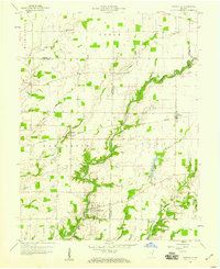
1958 Map of Hartsville
USGS Topo · Published 1959About this map
Hartsville serves as the focal point of this 1950s survey, marking a significant intersection of local history at the site of Hartsville College. The landscape is defined by the winding course of Clifty Creek and its many tributaries, including Little Haw Creek and Duck Creek. The area's rural character is underscored by a dense network of family-named cemeteries such as Swinney Cem, Galbraith Cem, and Pumphrey Cem, providing valuable touchpoints for genealogists. Transport and industry in this era were linked by the New York Central railroad, which served the small communities of Burney and Rugby. The map documents a snapshot of agrarian life before modern expansion, with clearly marked landmarks like Storage Bins and a Gas Well alongside traditional congregational centers like Bethel Ch and Haw Creek Ch.
Find a feature on this map
38 named features on this map. Tap any name to fly to it.
Don’t see what you’re looking for? This feature index may not catch every label — zoom into the map to look around manually.
Map Details
Editions of this 1958 Hartsville Map
4 editions found

Other maps of this area

1942 · Columbus
USGS Topo · 1:125,000

1947 · Hope
USGS Topo · 1:24,000

1948 · Hope
USGS Topo · 1:24,000

1948 · Lewis Creek
USGS Topo · 1:24,000

1950 · Edinburg
USGS Topo · 1:62,500

1953 · Cincinnati
USGS Topo · 1:250,000

1956 · Waldron
USGS Topo · 1:24,000

1957 · Cincinnati
USGS Topo · 1:250,000

1958 · Westport
USGS Topo · 1:24,000

1958 · Forest Hill
USGS Topo · 1:24,000