
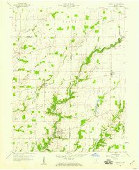
1958 Map of Hartsville
USGS Topo · Published 1959About this map
Clifty Creek carves a deep, winding path through this corner of Bartholomew and Decatur counties, anchoring a landscape defined by small rural hubs and historical burial grounds. The town of Hartsville sits at a strategic crossing, notable for the Hartsville College Cem which reflects the community's early educational roots. To the east and west, the New York Central railroad cuts a straight line across the drainage of Haw Creek and Duck Creek, connecting the settlements of Rugby and Burney. This mid-century survey captures the region just as the agricultural and industrial patterns of the era were firmly established, with numerous family-named cemeteries like Pumphrey Cem and Swinney Cem scattered across the uplands. The presence of Camp Clifty and the Gaging Sta along the primary waterway indicates the importance of these creek systems for both recreation and water management.
Find a feature on this map
41 named features on this map. Tap any name to fly to it.
Don’t see what you’re looking for? This feature index may not catch every label — zoom into the map to look around manually.
Map Details
Editions of this 1958 Hartsville Map
4 editions found
Other maps of this area

1942 · Columbus
USGS Topo · 1:125,000

1947 · Hope
USGS Topo · 1:24,000

1948 · Hope
USGS Topo · 1:24,000

1948 · Lewis Creek
USGS Topo · 1:24,000

1950 · Edinburg
USGS Topo · 1:62,500

1953 · Cincinnati
USGS Topo · 1:250,000

1956 · Waldron
USGS Topo · 1:24,000

1957 · Cincinnati
USGS Topo · 1:250,000

1958 · Westport
USGS Topo · 1:24,000

1958 · Forest Hill
USGS Topo · 1:24,000