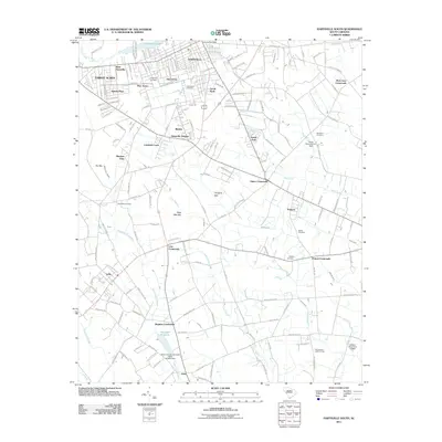
2011 Map of Hartsville South
USGS Topo · Published 2011About this map
Hartsville and its southern suburban expansion characterize this Darlington County landscape at the beginning of the 2010s. The map illustrates a transition from the urban grid near the Hartsville Post Office to numerous residential developments such as Glen Acres, Kalmia Place, and Pine Acres. Significant water features and lowlands define the local geography, including the expansive Boggy Gully Swamp and the waters of Prestwood Lake and Swift Creek.
Find a feature on this map
158 named features on this map. Tap any name to fly to it.
Don’t see what you’re looking for? This feature index may not catch every label — zoom into the map to look around manually.
Map Details
Editions of this 2011 Hartsville South Map
This is the sole edition of this map. No revisions or reprints were ever made.
Other maps of this area

1940 · Florence West
USGS Topo · 1:62,500

1941 · Spartanburg
USGS Topo · 1:250,000

1945 · Florence West
USGS Topo · 1:62,500

1953 · Florence
USGS Topo · 1:250,000

1953 · Spartanburg
USGS Topo · 1:250,000

1954 · Florence
USGS Topo · 1:250,000

1960 · Spartanburg
USGS Topo · 1:250,000

1963 · Spartanburg
USGS Topo · 1:250,000

1963 · Dovesville
USGS Topo · 1:24,000

1963 · Darlington West
USGS Topo · 1:24,000