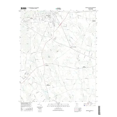
2017 Map of Hartsville South
USGS Topo · Published 2017About this map
Hartsville and West Hartsville anchor this Darlington County landscape, where the urban grid meets the intricate wetland systems of the South Carolina Coastal Plain. The northern boundary is defined by Prestwood Lake and the meandering path of Black Cr, while the surrounding countryside is characterized by numerous bay features including Boggy Gully Bay, Dargans Bay, and Bees Wax Bay. This 2017 survey reveals a network of rural hubs such as Flinns Crossroads, Rosa Lees Crossroads, and Lees Crossroads, which serve as waypoints between the agricultural fields and the dense swamps of Boggy Gully Swamp.
Find a feature on this map
163 named features on this map. Tap any name to fly to it.
Don’t see what you’re looking for? This feature index may not catch every label — zoom into the map to look around manually.
Map Details
Editions of this 2017 Hartsville South Map
This is the sole edition of this map. No revisions or reprints were ever made.
Other maps of this area

1940 · Florence West
USGS Topo · 1:62,500

1941 · Spartanburg
USGS Topo · 1:250,000

1945 · Florence West
USGS Topo · 1:62,500

1953 · Florence
USGS Topo · 1:250,000

1953 · Spartanburg
USGS Topo · 1:250,000

1954 · Florence
USGS Topo · 1:250,000

1960 · Spartanburg
USGS Topo · 1:250,000

1963 · Spartanburg
USGS Topo · 1:250,000

1963 · Dovesville
USGS Topo · 1:24,000

1963 · Darlington West
USGS Topo · 1:24,000