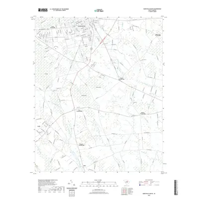
2020 Map of Hartsville South
USGS Topo · Published 2020About this map
Hartsville and its surrounding countryside are defined by a complex network of wetlands and historic crossroads in this modern survey. The municipal core is anchored by Prestwood Lake on Black Creek, with residential expansion reaching into West Hartsville. Beyond the city limits, the landscape transitions into a series of distinctive bays and swamps, including Dargans Bay and the extensive Boggy Gully Swamp. The distribution of rural settlements like Oats, Lydia, and Polson Crossroads reflects a long-standing pattern of community nodes situated between these water systems. Genealogists will find a significant concentration of burial sites, such as Magnolia Cem, Greenlawn Cem, and Snowhill Cem, which serve as key landmarks for family history research in this part of Darlington County.
Find a feature on this map
178 named features on this map. Tap any name to fly to it.
Don’t see what you’re looking for? This feature index may not catch every label — zoom into the map to look around manually.
Map Details
Editions of this 2020 Hartsville South Map
This is the sole edition of this map. No revisions or reprints were ever made.
Other maps of this area

1940 · Florence West
USGS Topo · 1:62,500

1941 · Spartanburg
USGS Topo · 1:250,000

1945 · Florence West
USGS Topo · 1:62,500

1953 · Florence
USGS Topo · 1:250,000

1953 · Spartanburg
USGS Topo · 1:250,000

1954 · Florence
USGS Topo · 1:250,000

1960 · Spartanburg
USGS Topo · 1:250,000

1963 · Spartanburg
USGS Topo · 1:250,000

1963 · Dovesville
USGS Topo · 1:24,000

1963 · Darlington West
USGS Topo · 1:24,000