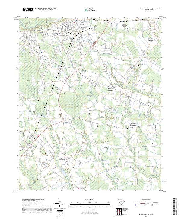
2024 Map of Hartsville South
USGS Topo · Published 2024About this map
Hartsville and its southern agricultural fringes dominate this landscape, characterized by a complex network of crossroads and wetlands. The transition from the urban streets of West Hartsville to the rural expanses below is marked by several distinct Carolina bays, including Bees Wax Bay and Dargans Bay, which break up the farmland with their unique elliptical depressions. These natural features, along with Boggy Gully Swamp, dictate the historical settlement patterns, forcing roads to navigate around the low-lying terrain. Several small communities and named junctions like Lydia and Oats serve as local hubs, while numerous country churches and their associated burial grounds, such as the Mount Calvary Graveyard and Bethel Church Graveyard, provide important touchpoints for family history researchers. The drainage of Swift Creek and Jeffries Creek further defines the rural topography of this Darlington County region.
Find a feature on this map
91 named features on this map. Tap any name to fly to it.
Don’t see what you’re looking for? This feature index may not catch every label — zoom into the map to look around manually.
Map Details
Editions of this 2024 Hartsville South Map
This is the sole edition of this map. No revisions or reprints were ever made.
Other maps of this area

1940 · Florence West
USGS Topo · 1:62,500

1941 · Spartanburg
USGS Topo · 1:250,000

1945 · Florence West
USGS Topo · 1:62,500

1953 · Florence
USGS Topo · 1:250,000

1953 · Spartanburg
USGS Topo · 1:250,000

1954 · Florence
USGS Topo · 1:250,000

1960 · Spartanburg
USGS Topo · 1:250,000

1963 · Spartanburg
USGS Topo · 1:250,000

1963 · Dovesville
USGS Topo · 1:24,000

1963 · Darlington West
USGS Topo · 1:24,000