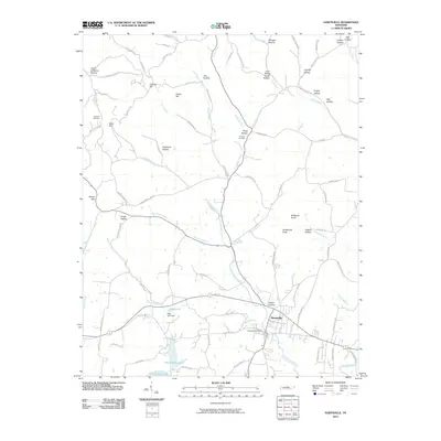
2010 Map of Hartsville
USGS Topo · Published 2010About this map
Hartsville serves as the focal point of this Trousdale County survey, situated where Little Goose Creek meets the southern waters of Old Hickory Lake. The landscape is defined by a dense network of family-named hollows and knobs, including Scruggs Hollow, Knight Hollow, and the prominent Millstone Knob. The town infrastructure is anchored by the Hartsville Post Office and the nearby Kelly Lake Dam, reflecting the importance of water management in this river-valley region.
Find a feature on this map
89 named features on this map. Tap any name to fly to it.
Don’t see what you’re looking for? This feature index may not catch every label — zoom into the map to look around manually.
Map Details
Editions of this 2010 Hartsville Map
This is the sole edition of this map. No revisions or reprints were ever made.
Other maps of this area

1931 · Lafayette
USGS Topo · 1:62,500

1931 · Adolphus
USGS Topo · 1:62,500

1942 · Gallatin
USGS Topo · 1:100,000

1955 · Bethpage
USGS Topo · 1:24,000

1955 · Hunters Point
USGS Topo · 1:24,000

1956 · Nashville
USGS Topo · 1:250,000

1958 · Westmoreland
USGS Topo · 1:24,000

1958 · Bellwood
USGS Topo · 1:24,000
1958 · Turners Station
USGS Topo · 1:24,000

1958 · Dixon Springs
USGS Topo · 1:24,000