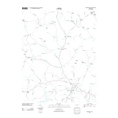
2013 Map of Hartsville
USGS Topo · Published 2013About this map
The Cumberland River corridor defines the southern boundary of this Trousdale County survey, where the town of Hartsville serves as a central hub for the surrounding rural landscape. The terrain north of the river is a network of named hollows and knobs, illustrating a settlement pattern deeply influenced by the ridge-and-valley topography. Notable elevations such as Millstone Knob and Sandstone Knob overlook a web of waterways, including Little Goose Cr and Hawkins Br, which historically dictated the placement of small communities like Willard and Green Grove.
Find a feature on this map
144 named features on this map. Tap any name to fly to it.
Don’t see what you’re looking for? This feature index may not catch every label — zoom into the map to look around manually.
Map Details
Editions of this 2013 Hartsville Map
This is the sole edition of this map. No revisions or reprints were ever made.
Other maps of this area

1931 · Lafayette
USGS Topo · 1:62,500

1931 · Adolphus
USGS Topo · 1:62,500

1942 · Gallatin
USGS Topo · 1:100,000

1955 · Bethpage
USGS Topo · 1:24,000

1955 · Hunters Point
USGS Topo · 1:24,000

1956 · Nashville
USGS Topo · 1:250,000

1958 · Westmoreland
USGS Topo · 1:24,000

1958 · Bellwood
USGS Topo · 1:24,000
1958 · Turners Station
USGS Topo · 1:24,000

1958 · Dixon Springs
USGS Topo · 1:24,000