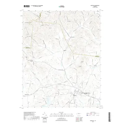
2019 Map of Hartsville
USGS Topo · Published 2019About this map
Hartsville serves as the primary hub of this landscape, situated near the confluence of Goose Creek and Little Goose Creek. The terrain is defined by a dense network of ridges and deep hollows, such as Sloan Hollow and Knight Hollow, which dictated the early placement of roads and farmsteads. Smaller communities like Green Grove, Willard, and Templow are scattered throughout these valleys, connected by winding routes like Green Grove Rd and Browning Branch Rd.
Find a feature on this map
133 named features on this map. Tap any name to fly to it.
Don’t see what you’re looking for? This feature index may not catch every label — zoom into the map to look around manually.
Map Details
Editions of this 2019 Hartsville Map
This is the sole edition of this map. No revisions or reprints were ever made.
Other maps of this area

1931 · Lafayette
USGS Topo · 1:62,500

1931 · Adolphus
USGS Topo · 1:62,500

1942 · Gallatin
USGS Topo · 1:100,000

1955 · Bethpage
USGS Topo · 1:24,000

1955 · Hunters Point
USGS Topo · 1:24,000

1956 · Nashville
USGS Topo · 1:250,000

1958 · Westmoreland
USGS Topo · 1:24,000

1958 · Bellwood
USGS Topo · 1:24,000
1958 · Turners Station
USGS Topo · 1:24,000

1958 · Dixon Springs
USGS Topo · 1:24,000