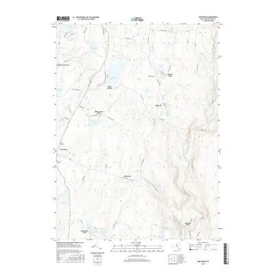
2016 Map of Hartwood
USGS Topo · Published 2016About this map
The Neversink River carves through this Sullivan County landscape, flanked by a network of upland lakes and small settlements. The community of Forestburg serves as a central point, with the Forestburg Cem and Saint Thomas Cem providing primary reference points for local genealogists. To the north, Saint Josephs and Saint Josephs Lake represent established enclaves, while the southeastern corner is defined by Oakland Valley and the winding course of the river near Denton Falls and High Falls.
Find a feature on this map
77 named features on this map. Tap any name to fly to it.
Don’t see what you’re looking for? This feature index may not catch every label — zoom into the map to look around manually.
Map Details
Editions of this 2016 Hartwood Map
This is the sole edition of this map. No revisions or reprints were ever made.
Other maps of this area

1906 · Port Jervis
USGS Topo · 1:62,500

1908 · Port Jervis
USGS Topo · 1:62,500

1909 · Monticello
USGS Topo · 1:62,500

1911 · Monticello
USGS Topo · 1:62,500

1913 · Milford
USGS Topo · 1:62,500

1915 · Milford
USGS Topo · 1:62,500

1922 · White Lake
USGS Topo · 1:62,500

1942 · White Lake
USGS Topo · 1:62,500

1942 · Port Jervis North
USGS Topo · 1:24,000
1942 · Otisville
USGS Topo · 1:24,000