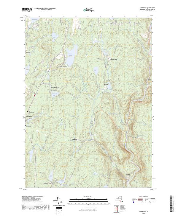
2023 Map of Hartwood
USGS Topo · Published 2023About this map
The Neversink River carves a deep valley through this Sullivan County landscape, serving as a primary corridor for early settlement and modern trail access. Communities like Forestburg, Hartwood, and Saint Josephs are established along the north-south routes, while the private enclaves of Merriewold Park and the Hartwood Club highlight the area's history as a destination for seasonal estates and outdoor recreation. These organized sporting and residential clubs grew around local water bodies such as Merriewold Lake and Hemlock Lake, shaping the land-use patterns seen today.
Find a feature on this map
85 named features on this map. Tap any name to fly to it.
Don’t see what you’re looking for? This feature index may not catch every label — zoom into the map to look around manually.
Map Details
Editions of this 2023 Hartwood Map
This is the sole edition of this map. No revisions or reprints were ever made.
Other maps of this area

1906 · Port Jervis
USGS Topo · 1:62,500

1908 · Port Jervis
USGS Topo · 1:62,500

1909 · Monticello
USGS Topo · 1:62,500

1911 · Monticello
USGS Topo · 1:62,500

1913 · Milford
USGS Topo · 1:62,500

1915 · Milford
USGS Topo · 1:62,500

1922 · White Lake
USGS Topo · 1:62,500

1942 · White Lake
USGS Topo · 1:62,500

1942 · Port Jervis North
USGS Topo · 1:24,000
1942 · Otisville
USGS Topo · 1:24,000