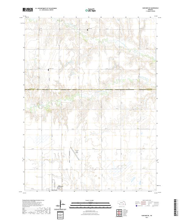
2021 Map of Harvard NE
USGS Topo · Published 2021About this map
Harvard anchors the southwestern corner of this survey, positioned where the grid of RD 320 and Airport RD meets the southern boundary of the quadrangle. The surrounding landscape in Clay and Hamilton Counties is defined by the drainage basins of the W Fork Big Blue River and its northern branch, the N Br W Fork Big Blue River. This region's agricultural character is evident in the meticulously organized section lines and the presence of localized water management features like Kreutz Reservoir and Mihm Reservoir. Significant for local historians, the map preserves the locations of rural burying grounds, including the Franklin Cem and Norwegian Cem, situated north of the Co RD 1 line. The infrastructure of the area is further marked by the Harvard State Airport, occupying a large tract just north of the town center.
Find a feature on this map
42 named features on this map. Tap any name to fly to it.
Don’t see what you’re looking for? This feature index may not catch every label — zoom into the map to look around manually.
Map Details
Editions of this 2021 Harvard NE Map
This is the sole edition of this map. No revisions or reprints were ever made.
Other maps of this area

1898 · York
USGS Topo · 1:125,000

1898 · Grand Island
USGS Topo · 1:125,000

1899 · York
USGS Topo · 1:125,000

1955 · Lincoln
USGS Topo · 1:250,000

1955 · Grand Island
USGS Topo · 1:250,000

1957 · Lincoln
USGS Topo · 1:250,000

1957 · Grand Island
USGS Topo · 1:250,000

1958 · Grand Island
USGS Topo · 1:250,000

1958 · Lincoln
USGS Topo · 1:250,000
1967 · Giltner
USGS Topo · 1:24,000