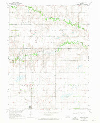
1969 Map of Harvard NE
USGS Topo · Published 1971About this map
Harvard occupies the southwestern corner of this survey, a hub of activity in Clay County during the late 1960s. The surrounding landscape is characterized by a dense grid of agricultural sections and a network of irrigation wells, highlighting the intensive farming operations of the era. To the east of the town site, the Harvard State Airport and a prominent Radio Tower serve as local aviation and communication landmarks.
Find a feature on this map
14 named features on this map. Tap any name to fly to it.
Don’t see what you’re looking for? This feature index may not catch every label — zoom into the map to look around manually.
Map Details
Editions of this 1969 Harvard NE Map
2 editions found
Other maps of this area

1898 · York
USGS Topo · 1:125,000

1898 · Grand Island
USGS Topo · 1:125,000

1899 · York
USGS Topo · 1:125,000

1955 · Lincoln
USGS Topo · 1:250,000

1955 · Grand Island
USGS Topo · 1:250,000

1957 · Lincoln
USGS Topo · 1:250,000

1957 · Grand Island
USGS Topo · 1:250,000

1958 · Grand Island
USGS Topo · 1:250,000

1958 · Lincoln
USGS Topo · 1:250,000
1967 · Giltner
USGS Topo · 1:24,000