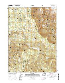
2014 Map of Harvey Creek
USGS Topo · Published 2014About this map
The Fremont National Forest dominates this high-altitude landscape in Lake County, characterized by the dramatic elevation changes of Winter Ridge and the Government Harvey Pass. The map traces the upper reaches of the Sycan River and its various tributaries, including the S Fork Sycan River and Skull Cr. This 2014 survey reveals a terrain defined more by natural features and forestry infrastructure than by dense settlement, showing a network of forest roads such as Natl Forest Develop Road 28 Rd. Notable local landmarks include Kates Dairy on the eastern edge and the distinct topography of Taylor Buttes to the southwest. Water sources like Cold Spring, Hogwallow Spring, and Phelps Spring are dispersed throughout the wooded highlands and the level expanses of Bennett Flat.
Find a feature on this map
37 named features on this map. Tap any name to fly to it.
Don’t see what you’re looking for? This feature index may not catch every label — zoom into the map to look around manually.
Map Details
Editions of this 2014 Harvey Creek Map
This is the sole edition of this map. No revisions or reprints were ever made.
Other maps of this area

1955 · Klamath Falls
USGS Topo · 1:250,000

1958 · Klamath Falls
USGS Topo · 1:250,000

1966 · Shake Butte
USGS Topo · 1:24,000

1966 · Slide Mtn
USGS Topo · 1:24,000

1966 · Sandhill Crossing
USGS Topo · 1:24,000

1966 · Harvey Creek
USGS Topo · 1:24,000

1966 · Fremont Point
USGS Topo · 1:24,000

1966 · Coffeepot Creek
USGS Topo · 1:24,000

1966 · Pole Butte
USGS Topo · 1:24,000

1966 · Lee Thomas Crossing
USGS Topo · 1:24,000