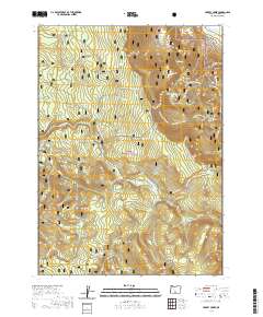
2020 Map of Harvey Creek
USGS Topo · Published 2020About this map
Winter Ridge and the steep elevation changes of the Fremont National Forest define this high-altitude landscape in Lake County. The mapping reveals a specialized network of seasonal access, dominated by the Sycan Wild and Scenic River and its tributary, the S Fork Sycan River. Settlement is nearly non-existent, represented primarily by Kates Dairy near the eastern boundary, suggesting a focus on forest management and remote ranching rather than township development.
Find a feature on this map
75 named features on this map. Tap any name to fly to it.
Don’t see what you’re looking for? This feature index may not catch every label — zoom into the map to look around manually.
Map Details
Editions of this 2020 Harvey Creek Map
This is the sole edition of this map. No revisions or reprints were ever made.
Other maps of this area

1955 · Klamath Falls
USGS Topo · 1:250,000

1958 · Klamath Falls
USGS Topo · 1:250,000

1966 · Shake Butte
USGS Topo · 1:24,000

1966 · Slide Mtn
USGS Topo · 1:24,000

1966 · Sandhill Crossing
USGS Topo · 1:24,000

1966 · Harvey Creek
USGS Topo · 1:24,000

1966 · Fremont Point
USGS Topo · 1:24,000

1966 · Coffeepot Creek
USGS Topo · 1:24,000

1966 · Pole Butte
USGS Topo · 1:24,000

1966 · Lee Thomas Crossing
USGS Topo · 1:24,000